Operations
OUR FOCUS
Laramie Energy’s primary geographic focus is the Piceance Basin of Western Colorado located in Rio Blanco, Garfield, and Mesa Counties. The Piceance Basin accounts for 20% of all Rockies gas production and is the second largest natural gas resource basin in the United States holding gas reserves in the tight sands of the Williams Fork reservoir and the underlying Mancos shale. Laramie is the third largest operating company in the Piceance Basin in terms of production, reserves and acreage.
Laramie Energy pursues low-risk geological and commercial development of unconventional gas resource plays, primarily in the principal Rocky Mountain basins of Colorado, Utah, Wyoming, and New Mexico.
Laramie is focused on large scale development areas and has excellent access to the West Coast markets, the Mexican market, and to the Mid-Continent market to support future production growth. Laramie employs a manufacturing style drilling program across its asset base to drive down costs and identify opportunities to increase operational efficiencies. High net revenue interests and large surface ownership provide the Company with flexibility on the development of its leasehold interests, reduced water handling and processing costs, and generate overall better investment returns.

KEY STATISTICS
GREATER THAN
ACRES
NET ACREAGE
THIRD LARGEST
PICEANCE PRODUCER
MMCFE/D
PRODUCTION
LARGE RESOURCE
TCF
RESOURCE ESTIMATE
WILLIAMS FORK:
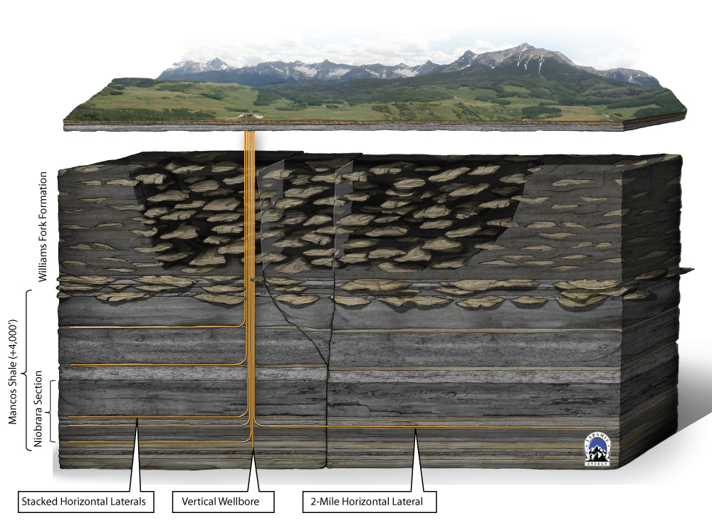
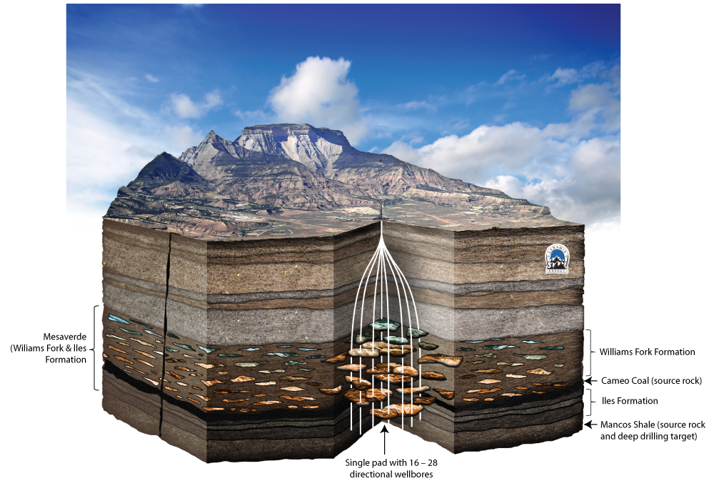
The Williams Fork formation is a 2,000 -3,000 foot thick stacked tight sand gas reservoir. Laramie Energy is currently focused on pad development with 16 to 28 wells per pad on 15-acre density.
MANCOS:
The Mancos is an emerging shale gas play with 3,000 to 4,000 foot thick intervals and has currently been recognized as the second largest shale gas resource in the U.S. just behind the Marcellus. Net to Laramie’s interest, the company estimates 30 Tcf of resource potential. Laramie’s 100,000 acres prospective of the formation is being developed both horizontally and vertically depending on the depth of the formation across the acreage.